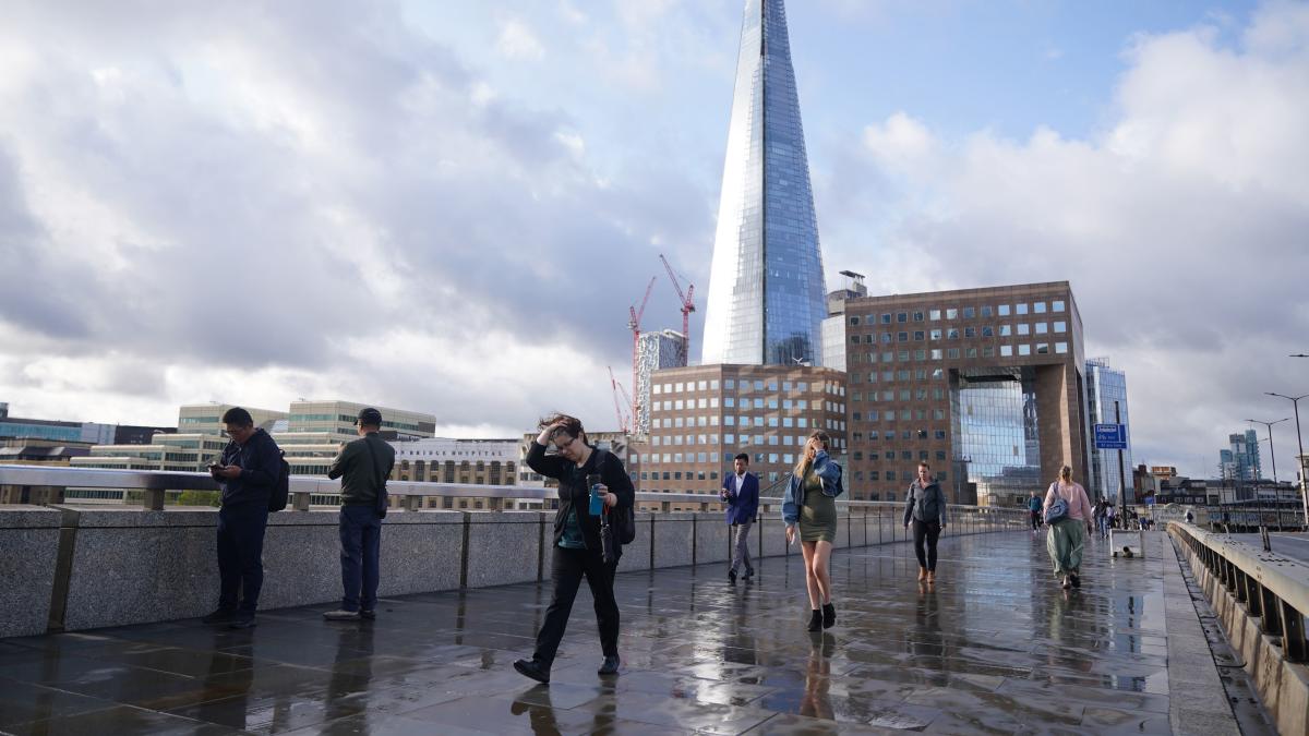
Flights have been cancelled and drivers urged to take care as Storm Lilian sweeps across parts of the UK ahead of what could be the busiest August bank holiday on the roads on record.
Strong winds of up to 80mph are forecast in northern parts of England and Wales on Friday, with travel disruption, flooding, power cuts and dangerous conditions near coastal areas likely.
British Airways has cancelled 14 flights scheduled to take off from Heathrow on Friday and delayed others, according to the airline’s website.
The cancellations include international flights to Italy, Switzerland and the US as well as domestic journeys to Scotland and Northern Ireland.
A spokesperson for British Airways said: “Due to restrictions imposed by air traffic control as a result of adverse weather across the UK, we’ve made some minor adjustments to our schedule.

“We’ve apologised to our customers for the disruption to their travel plans and to help get them to their destinations as quickly as possible.”
Two flights from Leeds Bradford Airport were cancelled on Friday while three morning arrivals were diverted to Liverpool, according to the airport’s website.
The Met Office has issued a yellow weather warning for rain spanning much of South East England from 6am to 1pm on Saturday.
The forecaster warned people in the affected area, which stretches from the Isle of Wight up to Ipswich in Suffolk and includes London, should expect “spells of rain, heavy at times, likely to cause some travel disruption and perhaps flooding in a few places”.
A separate wind warning was also in place across northern England and north Wales until 11am on Friday, with the storm widely expected to bring gusts of 50-60mph in the region.
The Met Office posted on social media site X on Friday morning: “Winds are now strengthening in many areas with the strongest winds occurring during the next few hours across northern England and north Wales.
“Damaging gusts are possible in places so ensure you stay #WeatherAware.”
The RAC estimates 19.2 million leisure trips by car will be made over the weekend, with 3.2 million on Friday alone.
This is highest since the motoring services company began recording data for the summer bank holiday in 2015.
RAC Breakdown spokeswoman Alice Simpson said the adverse weather and large volume of expected trips represents “a perfect storm” for drivers.
She said: “Anyone driving in areas impacted by Storm Lilian should try to avoid exposed coasts and higher routes where there’s a greater chance of fallen branches and trees. It’s vital to lower your speeds and leave plenty of extra stopping distance to allow yourself time to react quickly.
“Drivers should keep a firm grip on the steering wheel and take extra care when passing high-sided vehicles which can cause an unnerving buffeting effect when you’re suddenly hit by the wind on the other side.”
The impact of the severe weather has already been felt outside the expected regions, with National Highways warning the M48 Severn Bridge in Gloucestershire has been closed in both directions between junctions one for Aust and junction two for Chepstow due to strong winds.
Drivers are advised to use the M4 Prince of Wales Bridge as an alternate route.
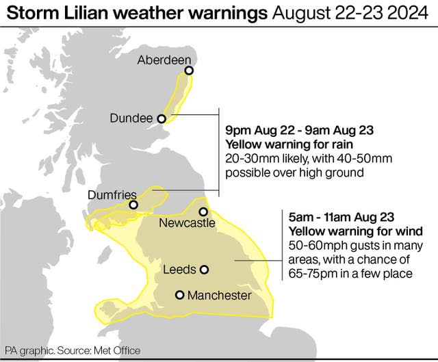

Met Office forecaster Greg Dewhurst said: “The strongest winds are likely to start forming through the early hours initially across parts of north Wales into the Liverpool, Blackpool area, and then crossing over the Pennines and into the east and north-east England – Yorkshire, up to Northumberland – before then clearing out into the North Sea.
“It’s really quite quick.”
On X, Reading and Leeds Festivals issued an “urgent weather report”, warning attendees to stay in their tents if they are already on-site and urging others on their way to delay their arrival.
Organisers at Leeds later said an end to the winds was “in sight”, adding the arena would not be opening at 11am but would be accessible “as soon as possible”.
They added: “However, we have definitely lost the BBC Radio 1 stage today, and there will be no performances on it.
“We have also lost the Aux stage today, and there will be no performances on it.
LEEDS URGENT WEATHER REPORT 🚨
Everybody can see and feel that we’re suffering from the winds currently. We’re urging you to stay in your tents if you are onsite and feel safe to do so. If you are in your car, please remain there. If you are not yet at the festival site, please…
— Reading & Leeds Fest (@OfficialRandL) August 23, 2024
“We remain hopeful that everything else will continue as planned and that we will still have an amazing weekend. Please await further information.”
Warning campers, Mr Dewhurst added: “The wind will pick up in that area through the night, particularly strongest towards dawn and then first thing in the morning, before then easing through the morning.
“There could be potentially some impacts from those strong winds, of 50-60mph in the area, so it’s worth making sure your tents are secured.”
A Network Rail spokeswoman said: “We are closely monitoring the potential impact that the storm might have on the rail network.
“We have teams on hand to put in appropriate measures, if necessary, to ensure that we can continue to run trains safely and as reliably as possible.”
Lillian’s influence should “wane” by Friday afternoon as it reduces in intensity and is pushed off into the North Sea, with scattered showers for most of the rest of the day, forecasters said.
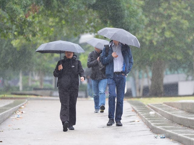

After the possibility of some heavy showers early on Saturday, settled conditions are likely to develop across southern and eastern England and Wales, with sunny spells and dry conditions mixed with the odd chance of scattered showers.
But the North and North West could continue to see “a fairly unsettled weekend”, with persistent rain in places, particularly parts of western Scotland and Northern Ireland.
Temperatures will reach highs of 21C on Saturday and Sunday and 23C on Monday in the South East, slightly below average for the time of year.
Lilian is the 12th named storm of the season – the furthest the Met Office has got through the list since it was introduced – and the first since April.
Storms are named when they have the potential to cause disruption or damage which could result in an amber or red warning, the Met Office said.

