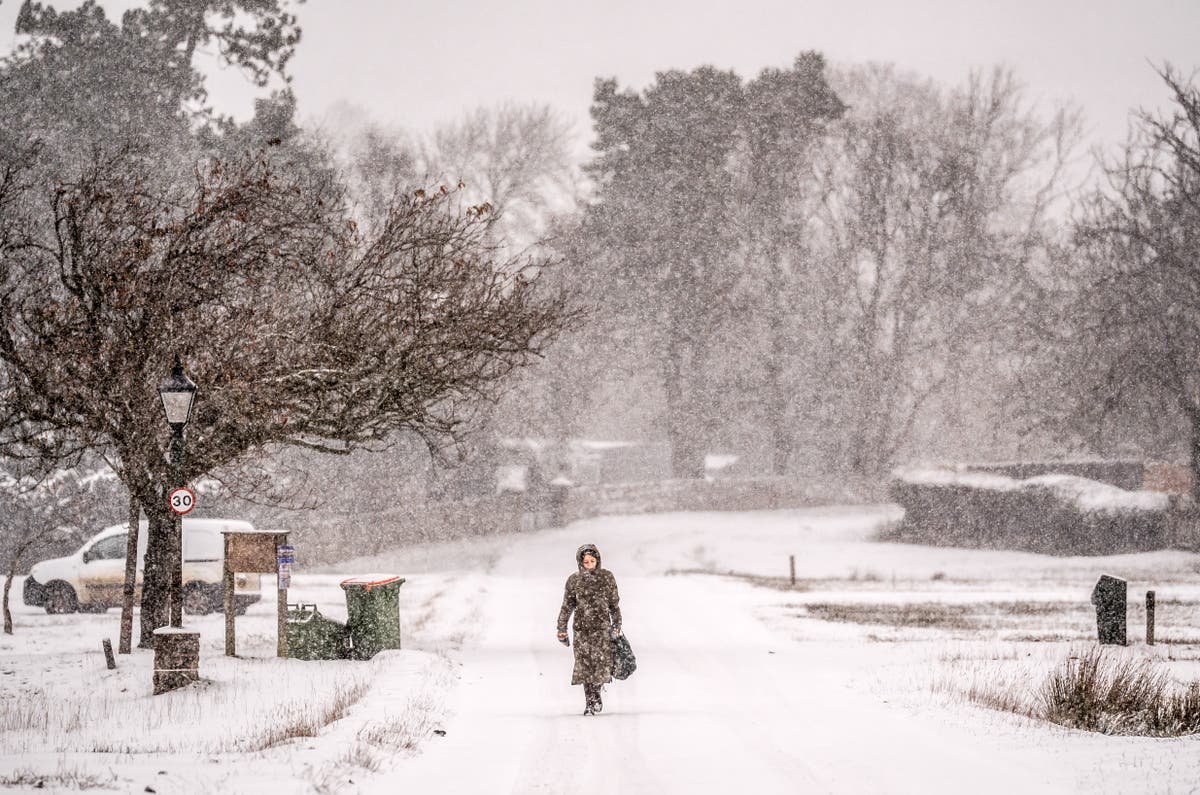
The Met Office has warned people to prepare for a weekend of rain, wind and snow as Storm Bert sweeps the country, with danger to life weather alerts in force on Sunday.
Weather warnings have been in place throughout the weekend as the country was hit by thick snow, torrential rain and winds in excess of 80mph after temperatures plummeted earlier in the week.
While Saturday saw two more severe amber warnings issued in relation to snowfall of up to 40cm, which caused “atrocious” travel disruption as it blanketed swathes of Scotland and England, authorities later warned that the worst was yet to come.
With heavy rain falling overnight and into Sunday, forecasters warned that a “rapid thaw” of the previous day’s snowfall could further contribute to potentially life-threatening floods, with nearly 400 areas deemed to be at risk as of Sunday morning.
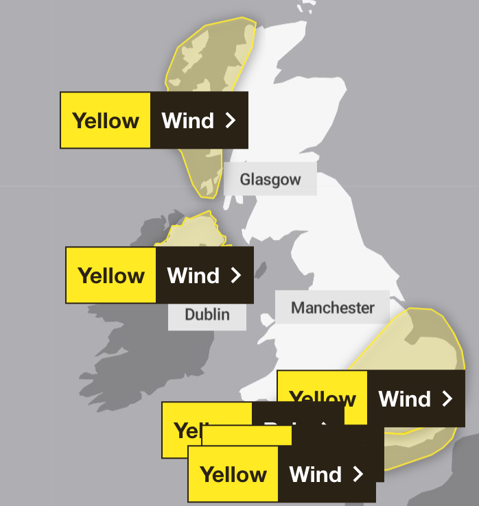
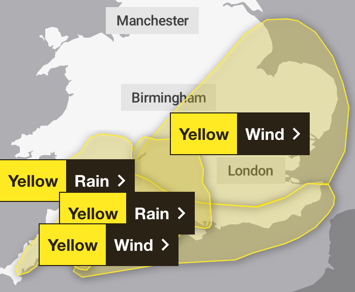
Despite some “exceptionally mild” temperatures on Sunday morning, some around 10C above the usual November maximum, there were still six Met Office weather warnings in force relating to wind and rain.
The entirety of Northern Ireland is subject to a warning over strong winds until 6pm, with forecasters predicting that delays to road, rail, air and ferry transport are likely, that coastal communities will be impacted by spray and large waves, and that loss of power and other services is possible.
The south coast of England is also covered by an alert for wind until 9pm, which also warns of “a small chance that injuries and danger to life could occur from large waves and beach material being thrown onto sea fronts, coastal roads and properties”, and “a small chance of injuries and danger to life from flying debris”.
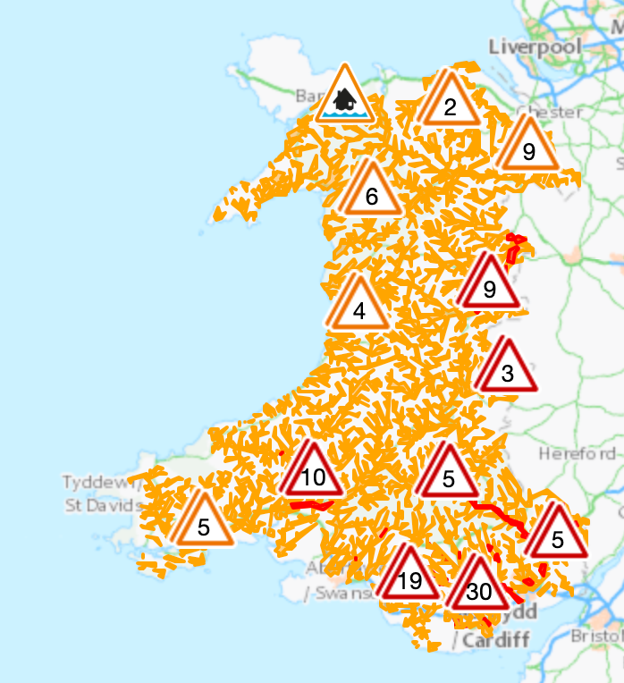
Further warnings for rain in southwest England and south Wales caution that some communities may be cut off by flooded roads, with homes and businesses flooded, with fast flowing or deep floodwater possible, causing a danger to life.
A warning for very strong winds has also been issued on the west coast of Scotland until midnight, which forecasters say are likely to bring disruption to transport, and dangerous coastal and marine conditions.
Met Office deputy chief meteorologist Dan Holley said: “Storm Bert marks a shift to much milder air and wintry hazards will gradually diminish through the weekend, but heavy snowfall is expected across parts of northern England and Scotland for a time on Saturday, especially over higher ground, and warnings are in place.
“Heavy rain through Saturday and Sunday, especially in southern and western parts of the UK, will also bring impacts for some with a number of warnings in place.”
He added: “In addition, rapid melting of lying snow over the weekend and periods of strong winds are likely to exacerbate impacts and bring the potential for travel disruption, as well as flooding for some.”
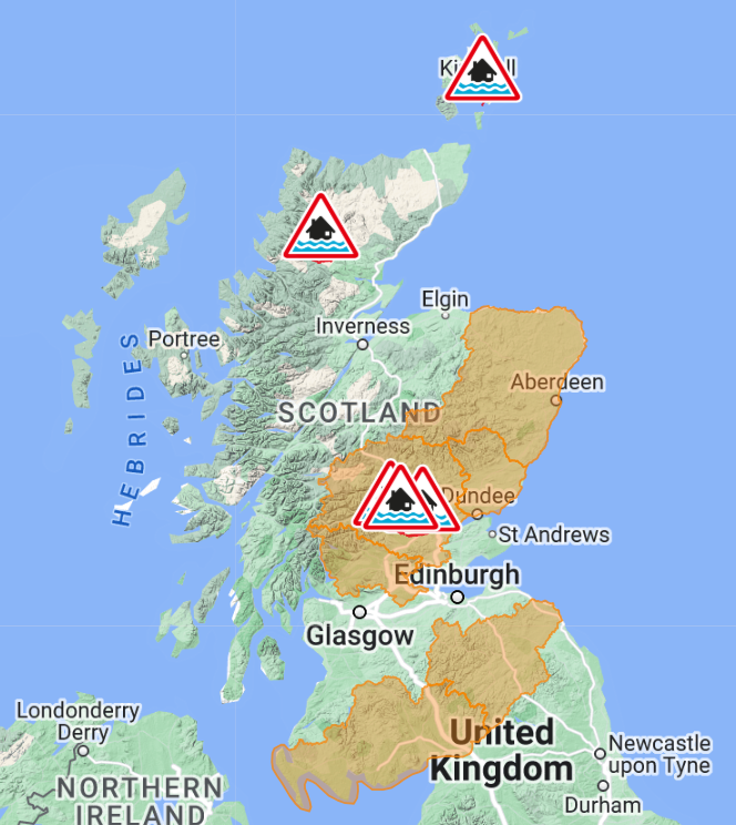
Indeed, by 3pm on Saturday, there were 26 flood warnings in force in England, along with 83 lesser flood alerts. There were six flood alerts covering swathes of southern and eastern Scotland, and one warning in Orkney, while Wales was subject to 41 alerts and five warnings.
By Sunday, the number of areas at risk of flooding had increased to nearly 400.
The Environment Agency has issued 76 flood warnings in England – meaning flooding is expected – and a further 193 flood alerts, which warn that it is possible.
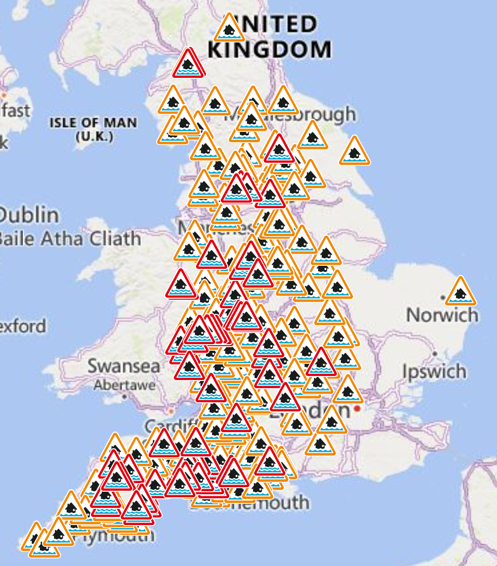
In Wales, there are 51 flood warnings in force – mostly in the southeast – and a further 60 alerts.
Scotland is subject to five warnings – one in Orkney, three in Tayside, and another at Strath Oykel – along with six alerts.
Unsettled weather is likely to continue into the start of next week, with strong winds and some showers for many parts. Although temperatures will be around average for most places, strong winds mean it will feel rather cold.
Looking further ahead, there are indications we could see a brief return to colder conditions with wintry showers for a time, especially in the north, before it becomes unsettled and milder again at the end of next week.

